

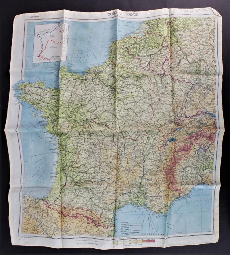
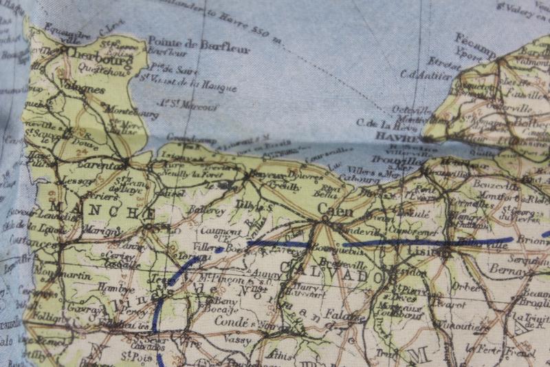
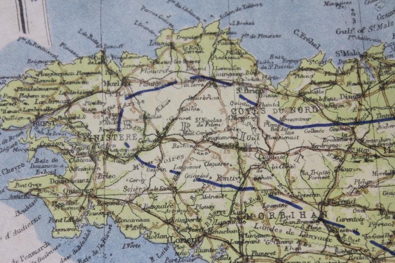
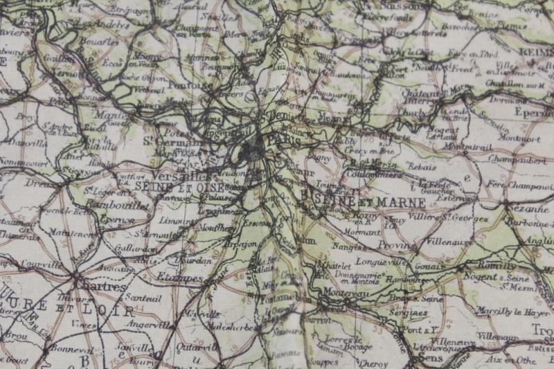
WW2 Silk Map ' Zones of France ' & Normandy Coastline March 1944
A rare March, 1944 dated "Zones of France", Scale 1:2.000.000, escape and evasion silk map with Normandy coastline .
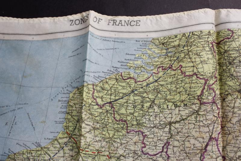
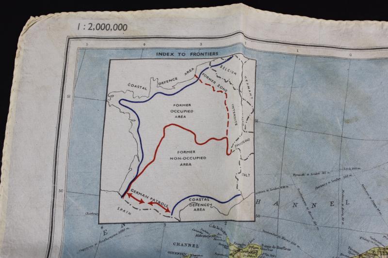
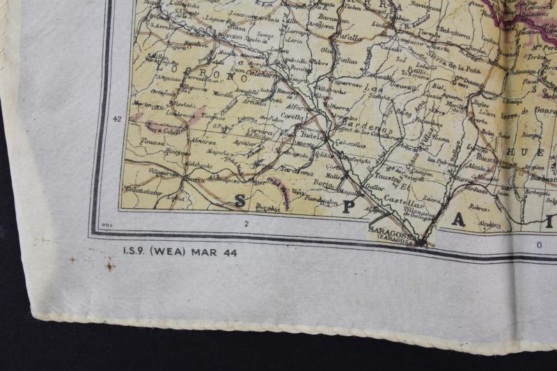
In February 1944, in preparation for D-Day, the Intelligence School No. 9 (IS9) responsible for Western European Area (WEA) produced a second edition of the rayon map of France, printed in colors on one side, 1:2.000.000 scale (1 cm for 20 km). This map, called Zones of France in reference to the division of France after the Armistice, was mainly issued to SOE agents, Jedburgh teams, Operation Groups of the OSS and American and British paratroopers involved behind enemy lines during the liberation of the territory.
Overall excellent condition.
Code: 12334